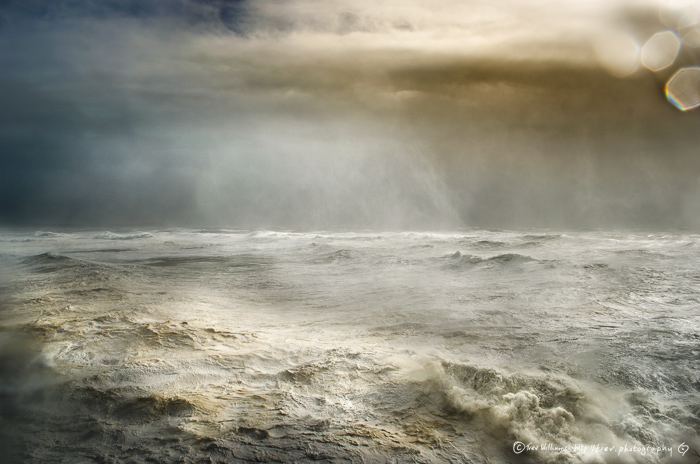
Looking out through the open doorway of our house; through horizontal stair-rods of rain I could see a tree in the front garden bending so hard that the tips of its branches were touching the ground. I really never thought that I would ever witness wind and rain like I saw that October. So it was uncanny to realise that the very same thing was likely to happen again and, coincidently, it would be 30 years to the day give or take a few hours.
In October 1987 I was 21 and living on the Sussex coast in England. In the early hours of the 16th a storm with sustained winds of 120kmh and gusts up to 190kmh rolled up the English Channel causing loss of life, property and widespread power failure. It was one of those notable life events that one always remembers. It represents a rite of passage of sorts; that I now use as a measure and reference in dating other events before or after it. As a newly enlisted photography student with a more than normal interest in the weather; I set about making pictures and recording the aftermath.
Ever since then I’ve harboured a wish to make a photograph during a storm; to capture something of the event itself rather than the aftermath. After arriving and living on Ireland's Atlantic shores, 20 years ago I’ve seen a good many winter storms come barrelling in, off the ocean, sometimes 3 or 4, one after the other; whipped and corralled by an oscillating jet stream to bring driving wind and rain.
For one reason or another I was never able to gather up the camera kit and record their bluster; however this time with methods for forecasting and broadcasting being so good I had plenty of time to prepare and ensure that I could be out with the camera when the winds blew. Despite the prior knowledge I still managed to snatch success from the jaws of disaster on a number of occasions including dodging a shed roof that landed on the road, avoiding a falling tree, escaping entrapment by another fallen tree. Not seeing the car washed away into the sea and right at the end of the day managing to shield the camera from a towering wall of sea water. It was also an emotional moment as I had to say a final goodbye to a long and trusted friend of 20 years - my Paramo waterproof jacket.
Location from where The Eye of Storm Ophelia was made
From Whence Ophelia Comes
Much of the essence or sense of place of West Cork has it’s roots in the sea. It’s not surprising given it’s geographic position. The collection of rocks, islands, peninsulas and bays that make up South West Ireland are the very outer extremities of a continent made ragged by battling air masses above and mountainous seas below. Rocky inlets and sheltered coves harbour muscle farms and kelp forests. On the land sheep and cattle graze lush fertile pasture made green by rain and sunshine and full of character ripe for songs and stories around a peat fire.
The events that start Ophelia’s genesis are all inconsequential on their own, and each could have petered out again; much like the many other similar events that had gone by before, without any claim to be part of something unusual. But instead, on the 3rd October, out beyond the continental shelf and above waters kilometres deep; vast masses of air began to meet above an ocean surface a tad warmer than normal, moving past each other and rubbing together, energised by sunshine and dragged by a revolving planet.
YouTube Video
Below is a video that I made that attempts to explain how Storm Ophelia formed and there is also footage of the storm and the effect it had on the area
